Blog

Glacier/Waterton, Part 3 – Crypt Lake

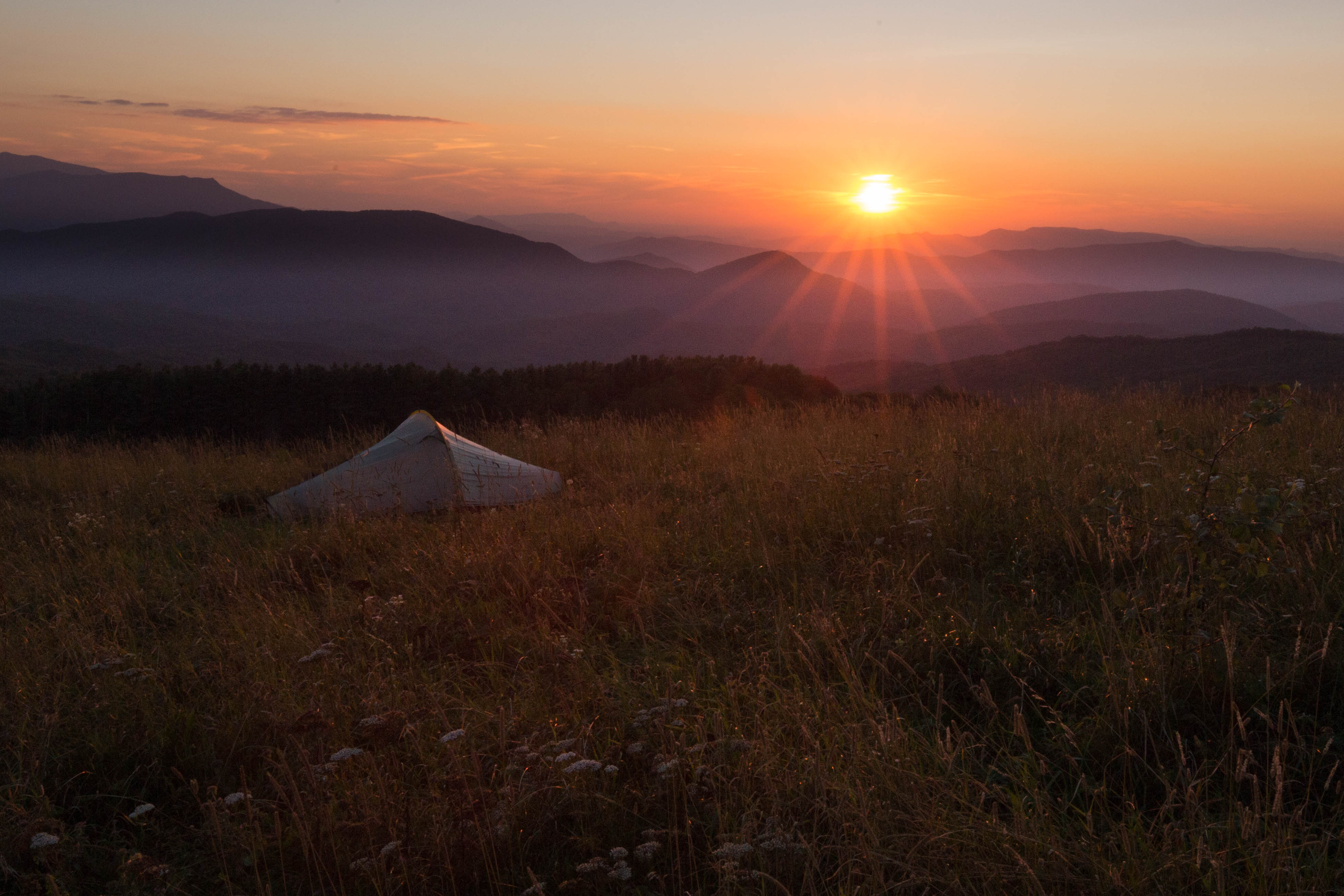
We didn’t have plans for Waterton other than to do some day hikes. Because of the nearby fires, there were only a few trails open so our options were very limited. The good news was that the trail to Crypt Lake was open. It was rated as one of the Top 20 most thrilling hiking trails in the world by National Geographic so it seemed like a no brainer.

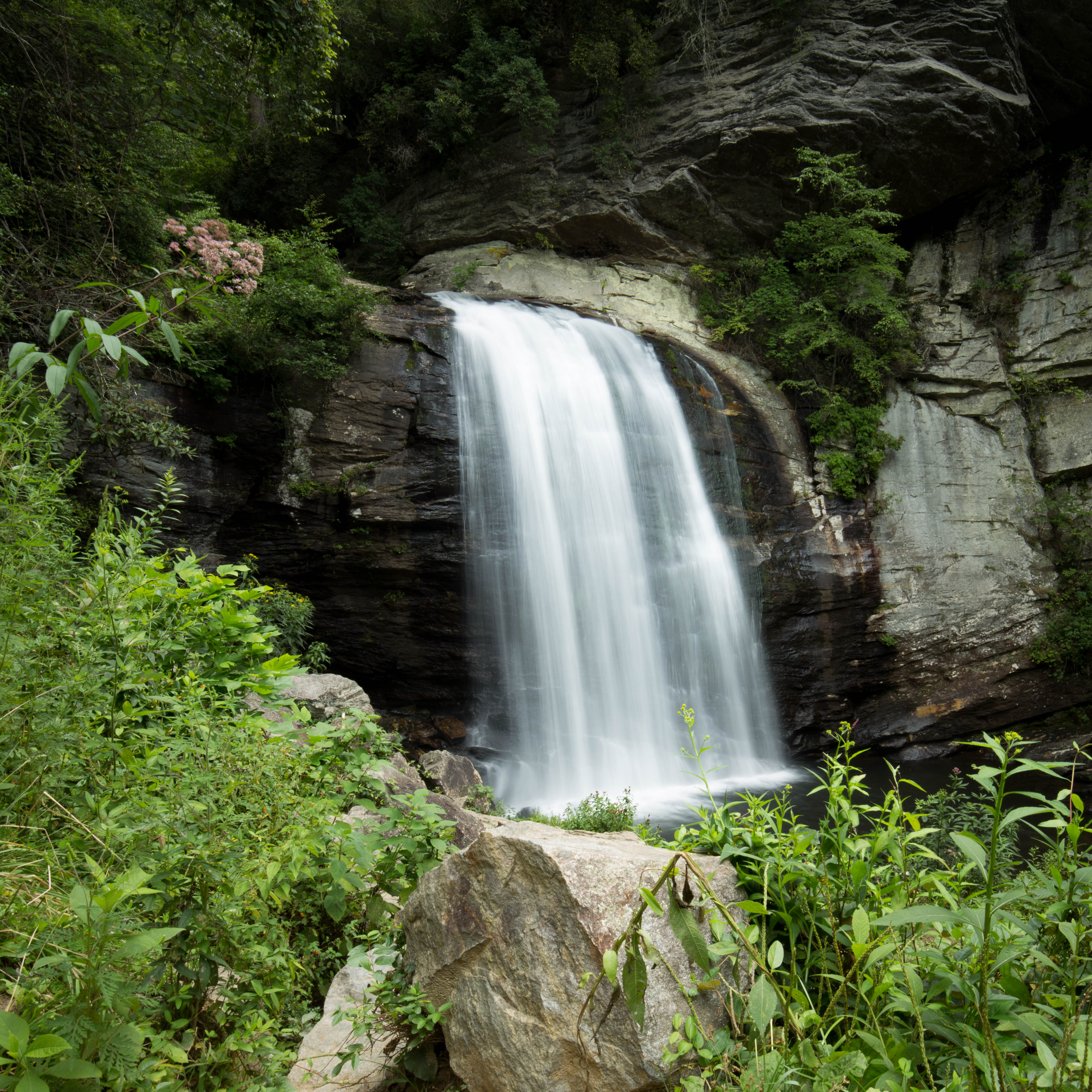
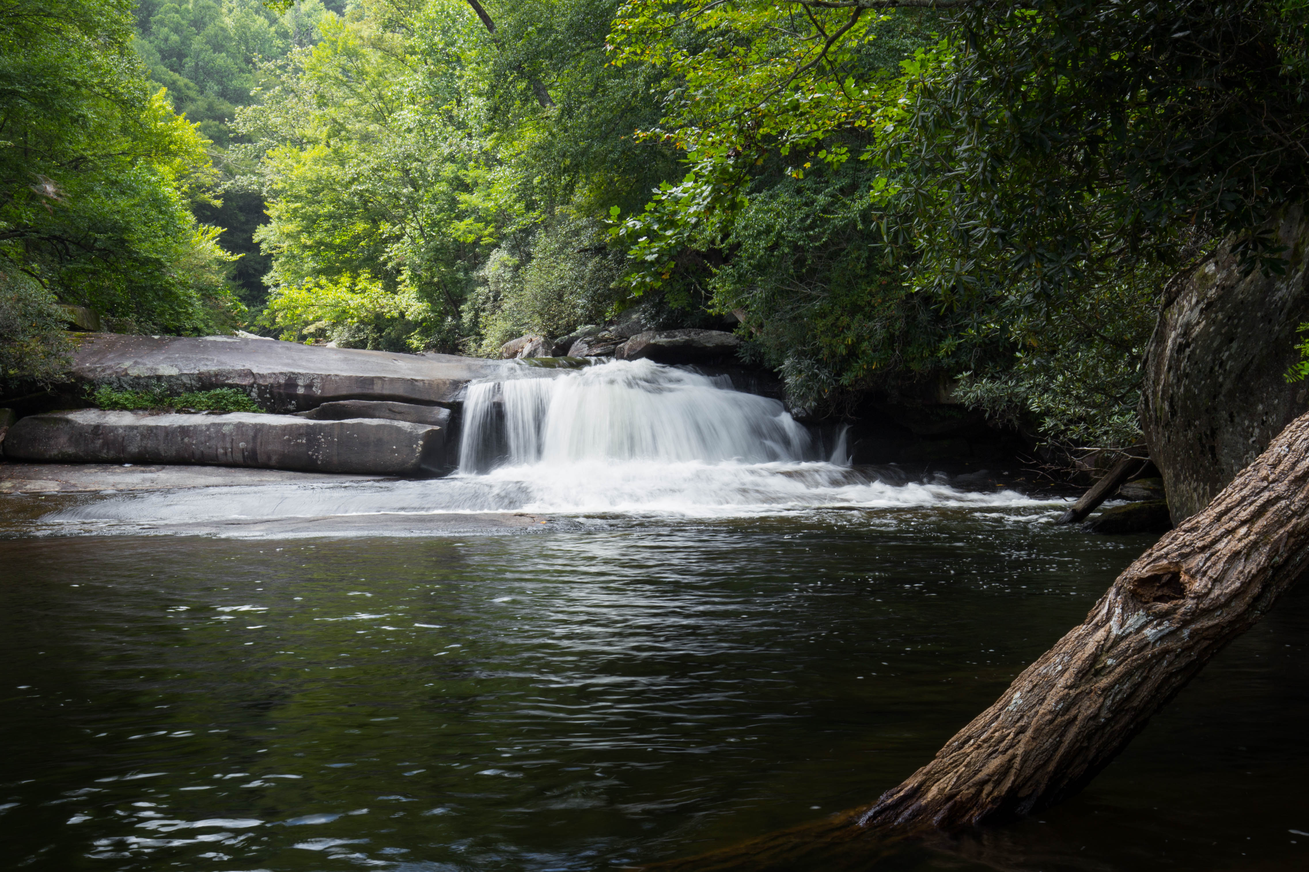
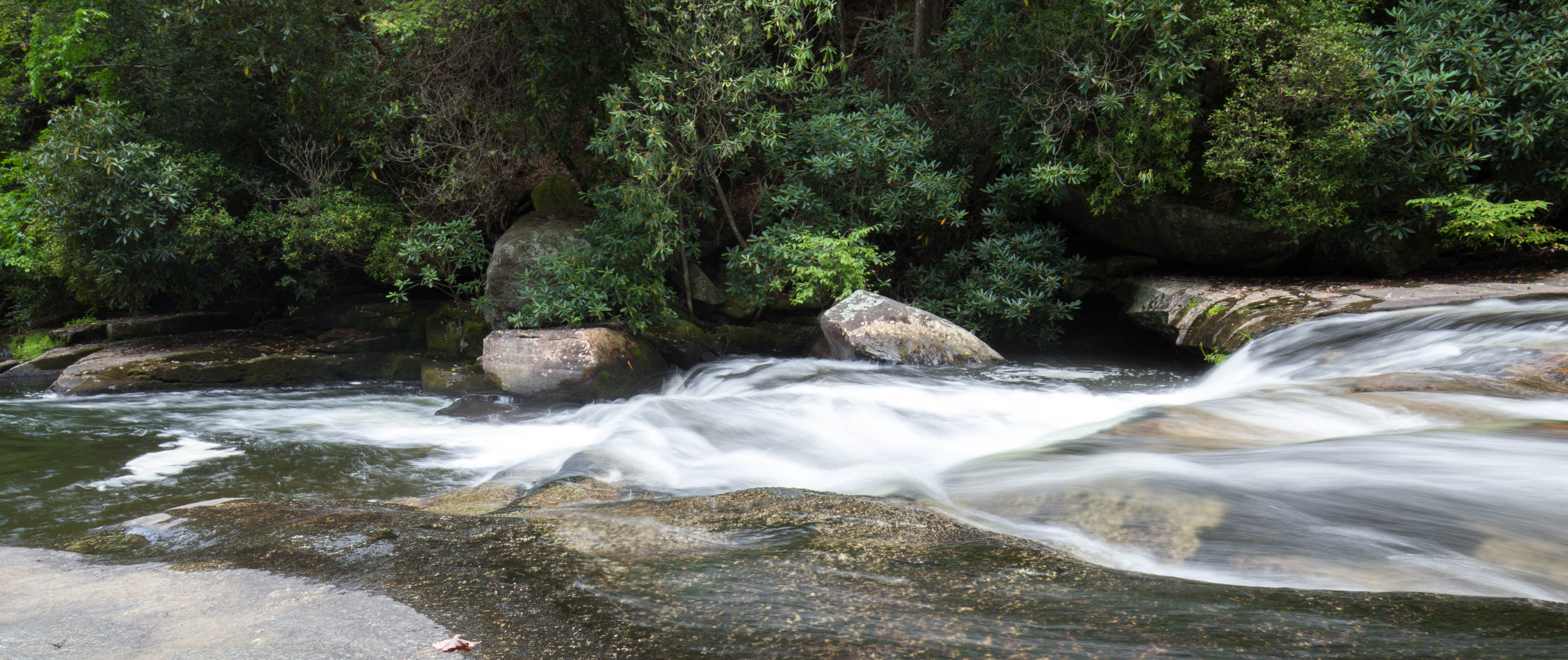
The Crypt Lake trailhead requires a ferry across Waterton Lake. The issue with taking a ferry is that everyone is starting the trail at the same time. We were behind ~20 people, and who knows how many more behind us. After a half mile or so, you have the option to take a side trail to some waterfalls. We were originally planning to do this on the way down from the lake, but decided it was better to do it at the start and get away from the crowds.

From the waterfalls, you hike through a forest eventually connecting back up with the main trail. There are a couple of other nice waterfalls along the river flowing through the valley below.

Once above the tree line, the trail starts to open up to nice a view.

As you get closer, the trail starts to narrow and gets very steep to the right. If you are afraid of heights, this is probably not going to be your favorite hike!

The narrow ledge that you hike along brings you to a tunnel which you must climb through.

On the other side of the tunnel, the trail begins to climb up. There is a chain anchored into the wall to assist with the climb. I can’t imagine trying to do this section without it! 

We finally reached the lake where we had a nice lunch and soaked in the sun.

We had some extra time on the way down so we stopped at one of the waterfalls we had hurried past on the way up.

While at the waterfall, we noticed the smoke from the fire across the lake had started to pick up. It eventually grew to cover the sun – very creepy!

We made it back to the main trailhead around 4 pm where we took the ferry back to the main dock. With the smoke becoming so intense, we decided to find a restaurant and hole up in inside. After dinner, the smell has decreased (or maybe we just used to it) so we headed back to camp.

Glacier/Waterton, Part 2 – Kayaking Swiftcurrent and Grinnell Glacier

Since our original trip had to be re-arranged, we ended up with an extra day before we needed to drive to Canada. We decided to grab some real food (aka not dehydrated), and then grab some beers and go kayaking on Swiftcurrent Lake.

After kayaking we got dinner and drinks at the Swiftcurrent Lodge. I was finally over my cold and treated myself to a yummy drink.

Since we did not have a campsite reservation for the night anymore, the park rangers allowed us to stay at the campsite with the PCT hikers (Pacific Crest Trail). We made a fire and hung out with them. Listening to their stories really makes me want to hike the AT or some long trail one day.

The next morning we joined the rest of the tourists and made the day hike to Grinnell Glacier.

After finishing the hike, we hopped in the car and headed to Waterton in Canada.

Glacier/Waterton, Part 1 – Many Glacier/Belly River

I am a little late to get this posted, but back in September my sister, her fiancee, and their friend joined me on a backpacking trip in Glacier National Park. Our original plans ended up getting scrapped due to fires and bear activity. The park service did an awesome job re-routing us so we could still complete a multi-day trip. We ended up with a 3 night trip in the Belly River / Many Glacier area. None of our days required a lot of hiking which was good for me as I was fighting off a cold 🙁

We started our trip at the Chief Mountain/Belly River trailhead and hiked to the foot of Elizabeth Lake. From Elizabeth Lake, we hiked to the Bear Mountain overlook and then onto the head of Glenns Lake. The next morning we made a short trip up to Mokowanis Lake before going to our final campsite of Cosley Lake.

At the trailhead

We saw a moose within the first mile of starting our hike…

The first few miles were mostly walking through sections of forests which then opened up into big fields. We saw a black bear in one field, but he was too far off to get a good photo.

We made sure to report our bear siting at the ranger station

Shortly after, we reached Belly River where we had to cross a swinging bridge.

We followed the trail for awhile along the river.

We eventually came across a waterfall. I believe it is named Dawn Mist Falls?

We eventually made it to camp at Elizabeth Lake. We hung out beside the lake for a bit hoping for a good sunset, but didn’t see much. It was still a nice view.

The next morning we started our hike to Glenns Lake. We had to backtrack slightly so we got to see the waterfall again.

Instead of crossing the swinging bridge like we had the day before, we continued along the river until we came to Cosley Lake.

We had to take our shoes off to cross the creek at the lake. Brrrrrrr. It was a little chilly. We set one the rocks for a little bit after soaking in the sun and letting our feet dry off before putting our boots back on and continuing on.

Since Glenns Lake wasn’t much further and it wasn’t even lunch yet, we decided to take a detour to Bear Mountain Overlook and have lunch there. It is a bit of a climb up there, but the view makes it worth it.

Clouds started forming as we climbed down the mountain. Glenns Lake was only a few miles away, but had clouded over by the time we arrived.

The next morning we decided to leave our stuff at Glenns Lake and hike to Mokowanis Lake. The sky was still very clouded over so we weren’t sure how much we would be able to see.

We ran into a deer along the trail – he seemed to be more interested in eating and completely ignored us.

From there we headed back to camp, grabbed our stuff, and headed to Cosley lake for our final night. I didn’t take many photos as most of our trail was backtracking from the day before.

At the end of the evening, we got to sit by Cosley lake and watch the last rays of sun hit the mountains. It was the best (and only) sunset we had the entire trip.

I believe Cosley Lake is also where we were awoken during the night to the bugle of an elk. And then some nice fog across the lake in the morning!

From Cosley Lake, we headed back to our original start – Chief Mountain/Belly River trailhead. We got an early start as we needed to find a campsite for the night (see note above about fires/bear activity) and knew that meant we had to get to the permit office early.

We passed a nice waterfall before joining back in with the original trail we came in on.

And then some supplies being brought in…

Virginia Hawkins Falls, SC

I saw online that the Foothills Trail Conservancy cleared trees at the bottom of the Virginia Hawkins Falls. I was in the area and figured I would go check it out. I parked at Laurel Fork Gap and walked the 1.5 miles to the falls (map of area can be found here). The last time I visited Virginia Hawkins was when Daniel and I kayaked across Jocassee. The hike along the gravel road was a bit easier, but not quite as exciting as the paddle trip.

Joyce Kilmer – Big Fat Gap to Hangover

Avery and I met Friday a few weeks back at at the Big Fat Gap trailhead in the Joyce Kilmer Wilderness area. It was pretty dark when we started hiking, but the trail wasn’t too bad with headlamps. We hiked about a mile or two along the Big Fat Gap trail to Slickrock Creek which is almost all downhill. Avery had wanted to stop at the campsites we passed near the start of the trail, but I knew the next day would be a long day and wanted to get a bit more mileage under our belts Friday. We setup camp once we reached the creek.

Saturday morning we cooked breakfast… which was interesting. I had a read a book earlier in the week about making pancakes while hiking. All you had to do was bring pancake mix, mix with water, and coat the pan with olive oil or butter. I wish I could say it was that simple… it ended up being a giant mess. Edible mess. But a mess. I don’t think we will be trying that again.

Once we managed to clean up breakfast and break down camp, we hid our bags in the bushes and hiked downstream to Wildcat Falls. We had to cross SlickRock creek once or twice to get there – it was definitely a bit slick!

We returned back to camp around 11ish, had a quick snack, and headed up the trail towards Naked Ground. The first mile or two was fairly easy. We reached the point where the trail diverted from the creek and started its ascent. We knew we had a lot of work ahead of us and decided to go ahead and have lunch and top off our water.

The trail from Slickrock Creek up to Naked Ground was hard. Not only did we have to gain over 2,000 feet in elevation, we had to climb over a hundred trees. I wish I could I say I was exaggerating, but I really think it was a hundred. You would climb over one tree and could see at least 2-3 more trees ahead of you. Hurricane Irma came through a few weeks before and I guess that caused so many trees to fall? I would not recommend the trail to anyone until some serious trail maintenance has taken place. It was brutal.

Finally we reached Naked Ground. There was a nice campsite which was very appealing, but we decided to push on to Hangover. It was around dusk when we finally reached Hangover – just in time for the sunset!

IMG_7666

IMG_7632

The sunrise the next morning wasn’t so bad either!

IMG_7699

We packed up camp Sunday morning and headed back to the car. It was a quick couple miles of downhill – thank goodness! If we had to go up more uphill, I probably would not have made it!


Max Patch, NC

Bella and I decided to check out Max Patch a few weekends back. We picked up some BBQ, beer, and a book and headed out on our adventure. The weather was simply amazing. We found an awesome spot and setup camp late in the afternoon, and then hung out/napped.

The view from the top of Max Patch is simply breath taking. You have a full 360 degree view.

IMG_6921

Bella and I watched the sunset. I think she may have enjoyed it more than me!


IMG_6963

IMG_6978

Lower Whitewater Falls

Bella and I hiked to Lower Whitewater Falls yesterday afternoon. The trail starts off on Duke Energy land at the Bad Creek parking lot. You follow the Foothills trail to start, then follow a gravel road for a bit, and finally end on an old logging road which leads down to the overlook. It took us about 2-3 hours to complete. I believe the entire is trip is about 4 miles (~2 miles each way).


Lake Jocassee, SC

Daniel and I went kayak camping on Lake Jocassee a few weekends ago. We started our journey off at Devils Fork State Park.

We paddled about 10 minutes and then noticed a bunch of clouds and rain coming in over the mountains to our left. We immediately picked up the pace and headed for the closest section of shore we could find.

OLYMPUS DIGITAL CAMERA
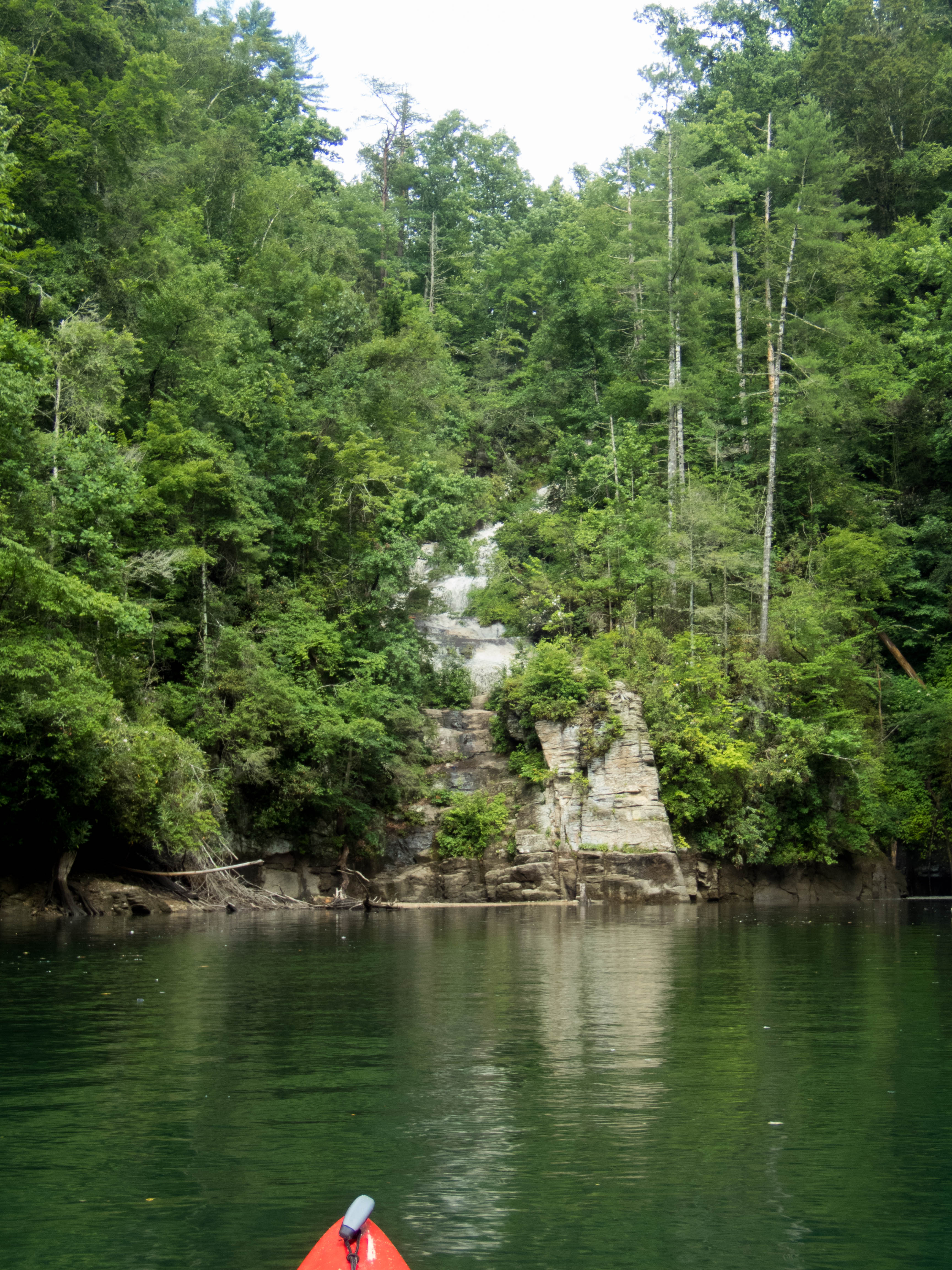
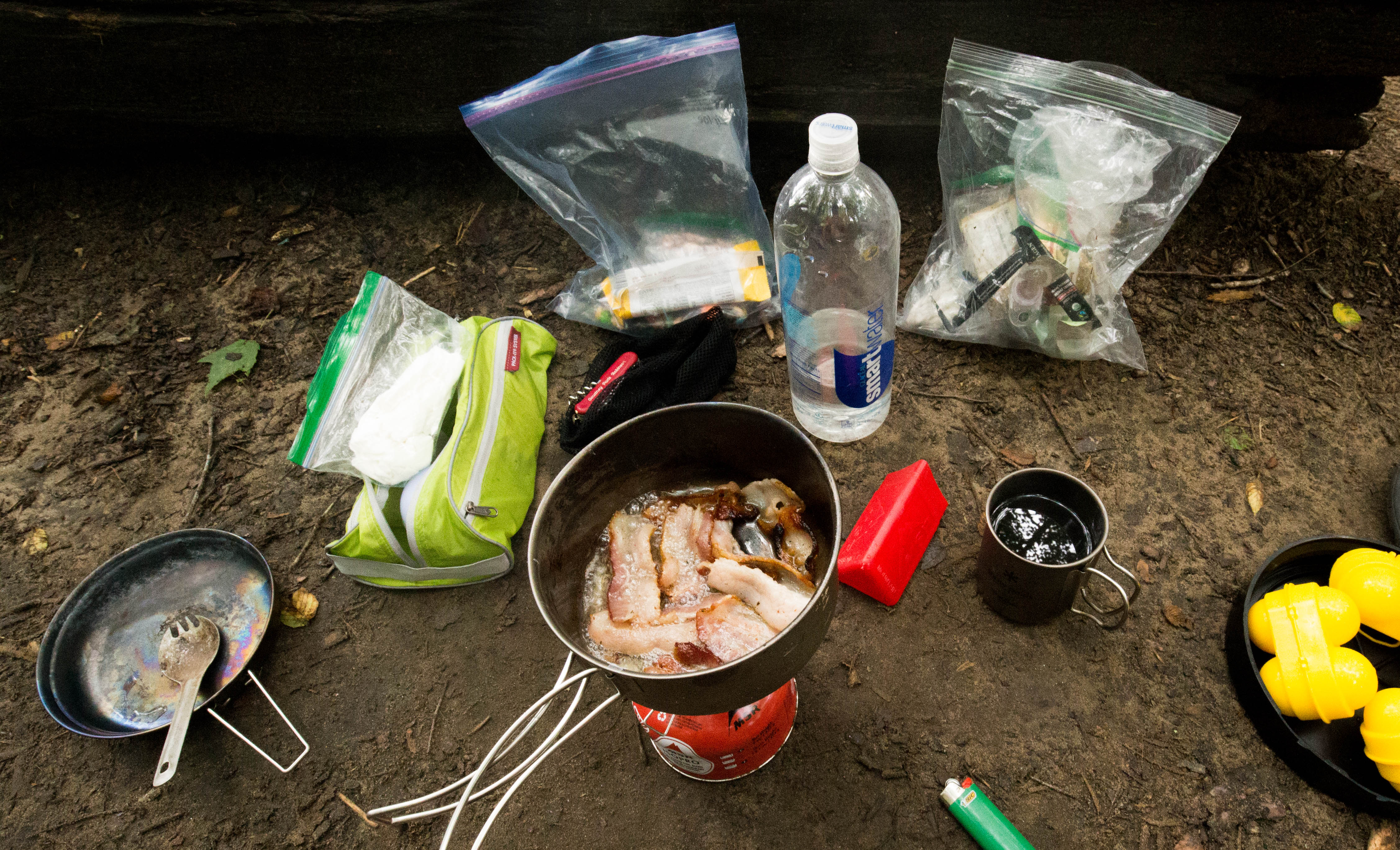
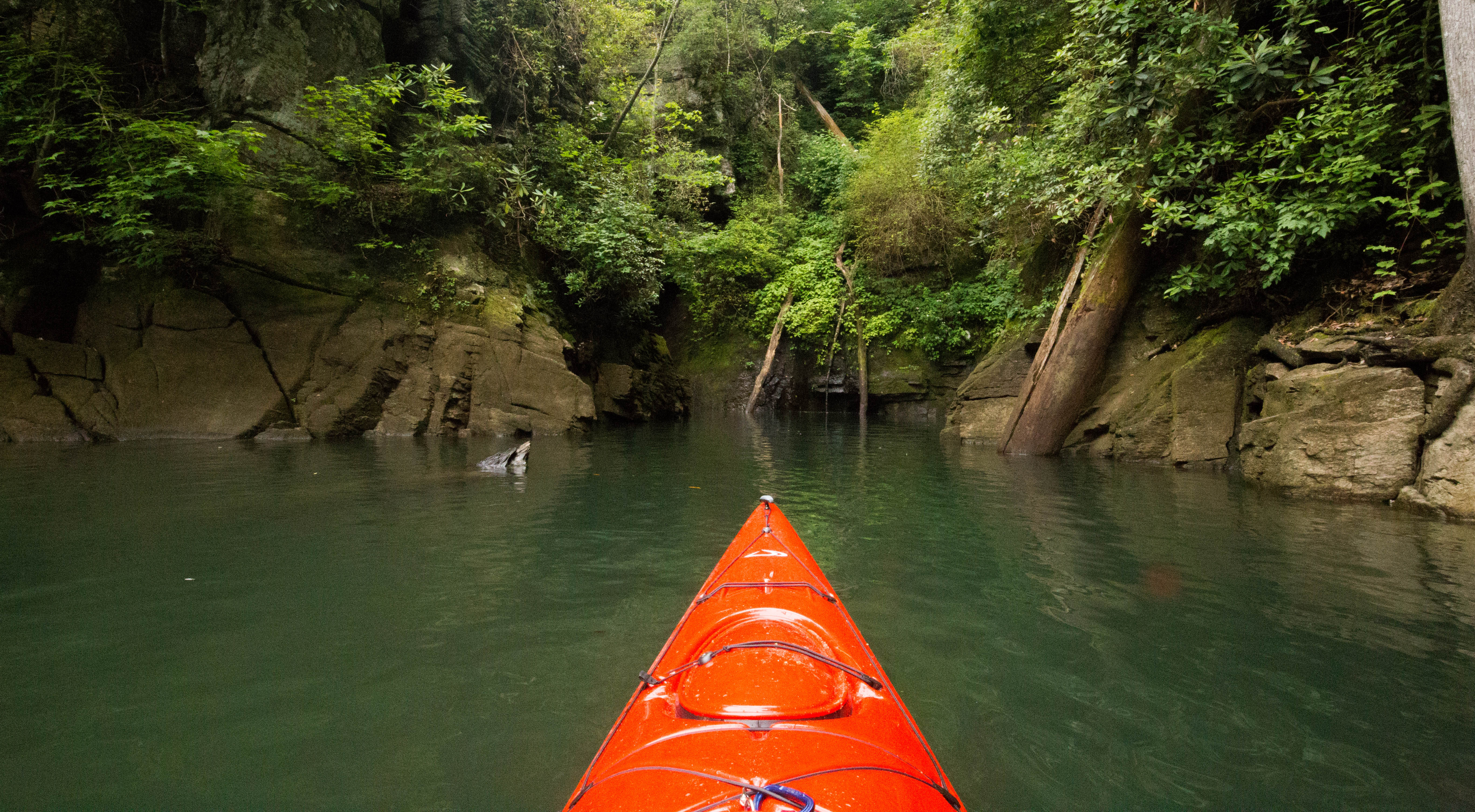
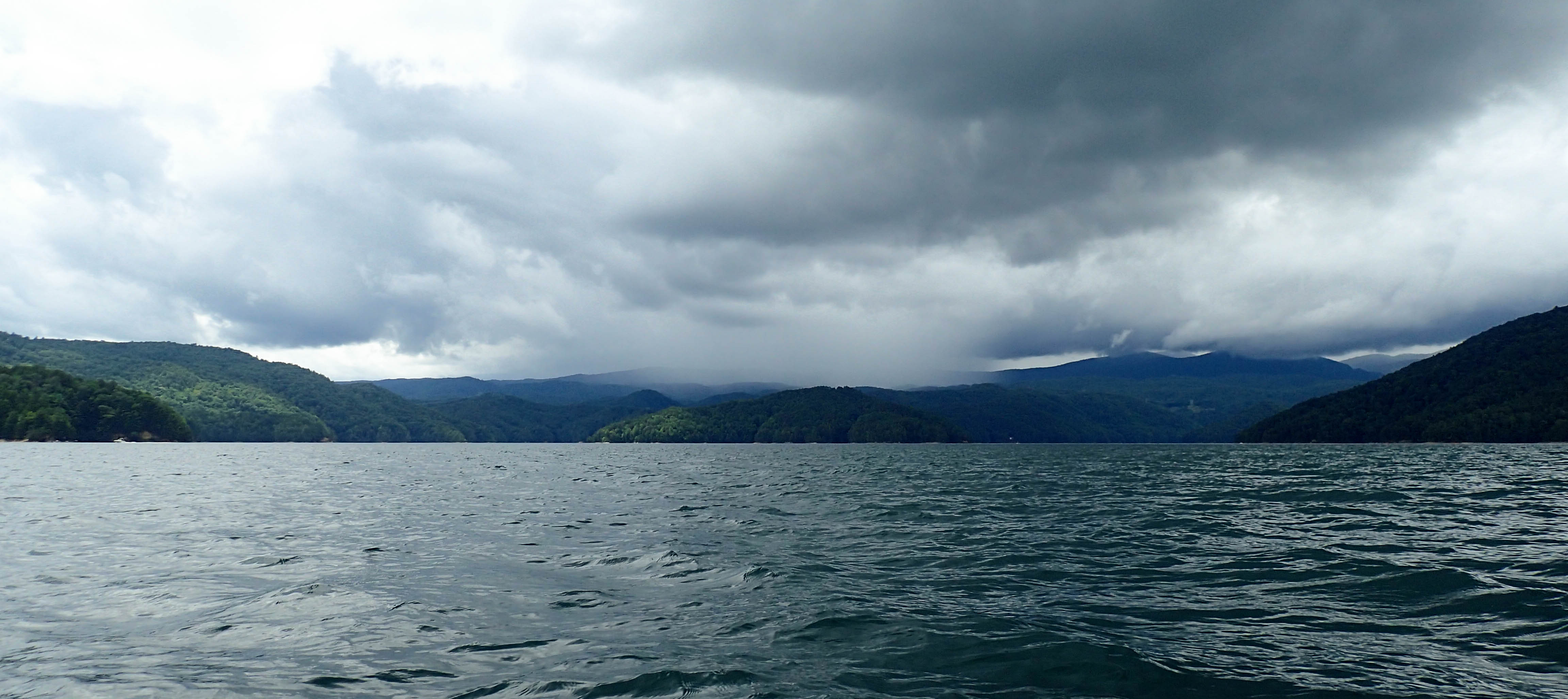
We found ourselves a small beach cove named “Happy Cove”. We puled our boats up on shore and hid under a bank while the rain passed.

After the rain passed, we jumped in our boats and began paddling again.

After 6 miles of paddling, we came across a small waterfall. When we heard the noise of the falls, we thought we had arrived at Laurel Fork, but once seeing the falls, knew we had a bit further to go.

We paddling a little bit further and caught our first glimpse of Laurel Fork.

OLYMPUS DIGITAL CAMERA

We parked our boats at the bottom and climbed up the rocks to check out the falls. We had to cross a bit of mud, but we made it across. There was a lot of water flowing over the falls due to the recent rain.

We decided it was so difficult to try and carry our bags up the rock face to the campsite on the map so we back paddled a few minutes to the Laurel Fork Boat Ramp. We packed our stuff into our bags and hiked the .5 miles to the campsite. We stopped and checked out a few campsites, but we finally found the perfect spot – at the very top of Laurel Fork Falls.

IMG_5834

The next morning we started our morning out with a filling breakfast of eggs and bacon.

IMG_5842

We then hiked to Virginia Hawkins Falls. It is a pretty waterfall about 2 miles from our campsite.

After visiting Virginia Hawkins, we grabbed our stuff from our campsite and headed back to our boats. We packed our stuff up and checked out the falls once more.

IMG_5897

IMG_5932