Bella and I decided to tackle the Foothills Trail earlier this month – a 77 mile trail along the border of North and South Carolina. According to Backpacker Magazine, it is one of the top long trails in the US. I have hiked a few sections around the Laurel Fork and Whitewater regions, but most of the trail was unchartered territory for me. Since I had some extra PTO this year, I decided I would complete the trail start to finish.
My original plan was to hike the trail in 5 days/4 nights, but after not getting in as much mileage as I would have liked the first two days, it turned into a 6 days/5 nights trip. If you do this trail, I will warn you that the trail is constantly going up/down so getting in lots of miles each day may not be as easy as some other trails (or maybe I am just not as in shape as I used to be?).
I went back and forth about whether to start at Oconee State Park and hike east, or start at Table Rock and hike west. I settled on Table Rock so I could get the worst of the climbing done on the first day. Here is an overview of my trip:
- Day 1: Table Rock State Park to Rock Creek Camp (Miles 0.0 to 10.4, Daily mileage: 10.4 miles)
- Day 2: Rock Creep Camp to Laurel Fork Falls Camp (Miles 10.4 to 22.6, Daily mileage: 12.2 miles)
- Day 3: Laurel Fork Falls to Bear Creek Camp (Miles 22.6 to 38.7, Daily mileage: 16.1 miles)
- Day 4: Bear Camp Creek to East Fork Camp (Miles 38.7 to 53.0, Daily mileage: 14.3 miles)
- Day 5: East Fork Camp to Licklog Campsite (Miles 53.0 to 67.2, Daily mileage: 14.2 miles)
- Day 6: Licklog to Oconee State Park (Miles 67.2 to 76.2, Daily mileage: 9 miles)
Day 1: Table Rock State Park to Rock Creek Camp (Miles 0.0 to 10.4, Daily mileage: 10.4 miles)
My mom dropped us off at Table Rock State Park around 10 am. It was chilly getting out of the car, but once we were hiking, we quickly warmed up and started shedding layers. I had expected to see more people along the trail, but it seemed like we were the only ones out there. The first mile follows Carrick Creek which has a few small cascades and water slides. The trail eventually departed the creek and started ascending to Pinnacle Mountain.


Near the summit to Pinnacle Mountain, the trail opens up to a large rock face with views to the south. What a view! We enjoyed a short rest before continuing on.

Shortly after the rock face, the trail splits. The Foothills Trails turns to the left, while those wanting to summit Pinnacle Mountain keep heading up. I was glad to skip the summit – we had already climbed up about 1600 feet! The trail then passes another rock face known as the Drawbar Cliffs which look more to the west. We didn’t stay too long as we still had many miles ahead of us.

We made it to the Lighthouse campsite around 1:30 pm (3.5 hours of hiking). We took the opportunity to have some lunch and review the map… at this point I realized we were not moving very fast and that we were probably not going to make it to the Chimney Top Gap campsite on Day 1 (we had only gone 5 miles and Chimney was still 8.1 miles away!). I figured we still had about 5 hours of sunlight so we could still get some miles in, but probably not 8.

Creek crossing 
Flowers 
Cantrell Campsite
We made it to the Cantrell Campsite around 4 pm. At this point we were exhausted and I was ready to setup camp, but I was also disappointed that we had only completed 8 miles for the day instead of the 13 I had planned. There was a nice gentleman there that was setting up his camp. He had completed the trail back in September and was quite familiar with the sections. He told us the 1.1 miles from Cantrell campsite to Sassafras Mountain was pretty flat compared to what we had already done so we decided to press on to Sassafras.

View from Sassafras 

SC/NC State line
We reached the summit of Sassafras around 4:45. There is a nice viewing area at the top with a full 365 degree view (fun fact: it is the highest mountain in the state of South Carolina). The sun was getting low in the sky so I knew we needed to hurry to find a campsite (camping is not allowed at the Sassafras summit). My guidebook showed a campsite about ~.7 miles alway, but I wasn’t sure about water (at this point, we were getting low). If there was no water there, we would need to keep going. We made it to the Rock Creek campsite and found a tiny tiny stream. It wasn’t much, but it would do!

Rock Creek Campsite 
Tired puppy 
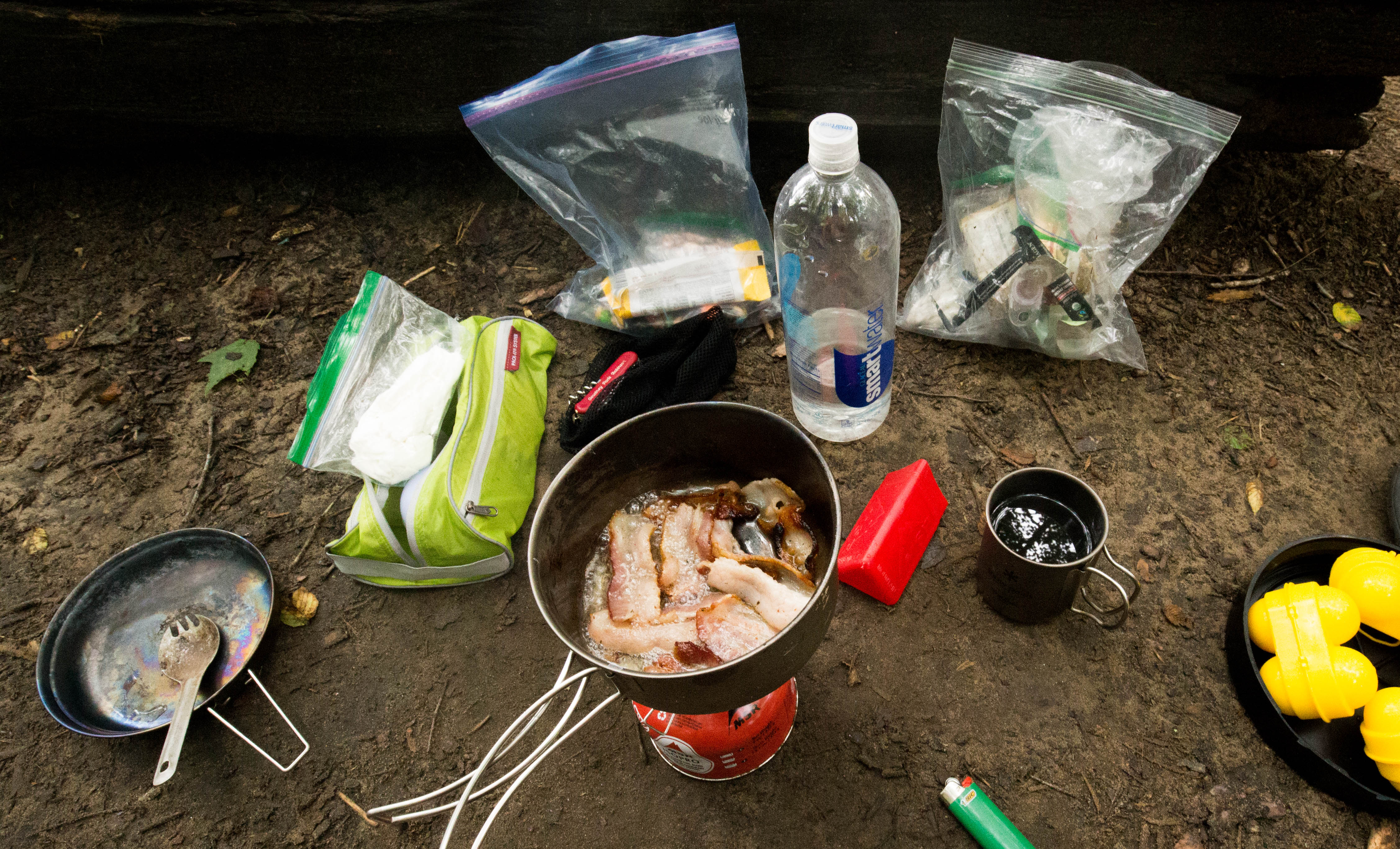
Bella’s dinner of sweet potatoes, green beans, chicken and rice before being cooked
Day 2: Rock Creep Camp to Laurel Fork Falls Camp (Miles 10.4 to 22.6, Daily mileage: 12.2 miles)
We woke up fairly early and were able to hit the trail by 8:30. We made it across US 178 road crossing fairly early in the morning, but then things took a turn. The hike from US 178 to Virginia Hawkins was much tougher than I had anticipated. I am not sure if it was because we were still tired from the day before or what. We made it to Virginia Hawkins area around lunch time only to find that we had to take a detour around the falls because a fallen tree made the bridge above the falls impassable. The detour follows an old logging road and added extra mileage we had not anticipated, plus required some back tracking if you still wanted to go view the waterfall. We decided to skip the falls and not backtrack since I have seen it multiple times before (once with Daniel, and another time with just Bella).
We followed the creek down through Laurel Valley reaching the Laurel Fork campsite around 2:30. We were exhausted and my feet hurt so we decided to call it a day. The campsite was empty when we started setting up our tent, but 2 or 3 other groups of people arrived by night fall. The Laurel Fork area is a popular area for weekend hikers.


Day 3: Laurel Fork Falls to Bear Creek Camp (Miles 22.6 to 38.7, Daily mileage: 16.1 miles)
We once again got up early on Day 3 and were out of the campsite before any of our neighbors had awoken. We briefly stopped at the overlook of Laurel Fork Falls. If you ever visit the area, I would suggest coming in from the lake – only half of the falls is visible from the overlook. From Laurel Fork, we weaved in and out of a trail path and old logging roads. This section was not very exciting. What was also not very exciting was the climb up Heartbreak Ridge – so many steps! You climb up to the top of a ridge, only to come right back down. There must have been over a hundred steps!


At the bottom of Heartbreak Ridge (along the lake/Toxaway Creek) are some really cool campsites. We took a short break by the creek and I soaked my feet in the cold water. We then crossed the large suspension bridge that spans the Toxaway River as it spills into Lake Jocassee.

Toxaway Creek 
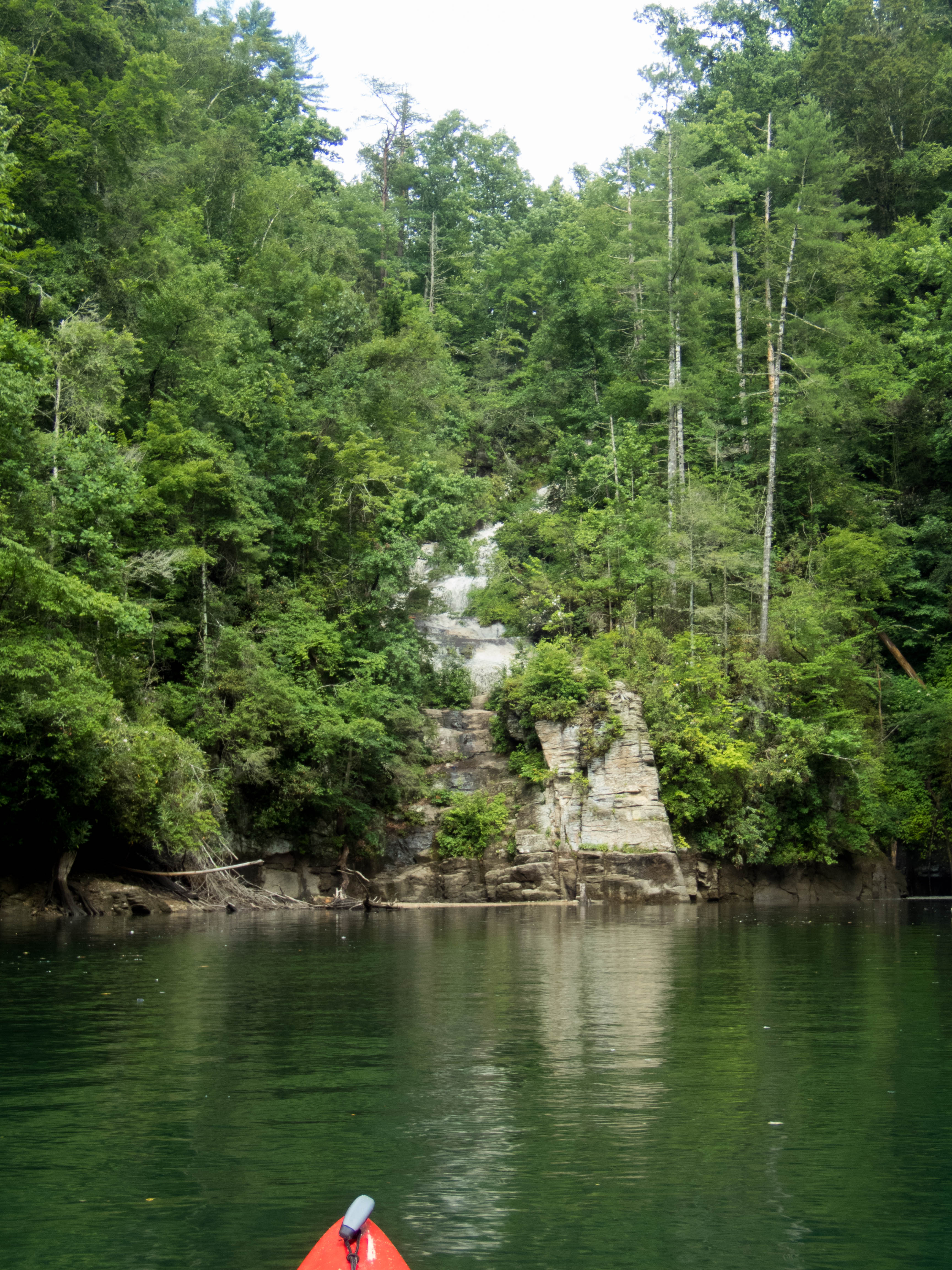
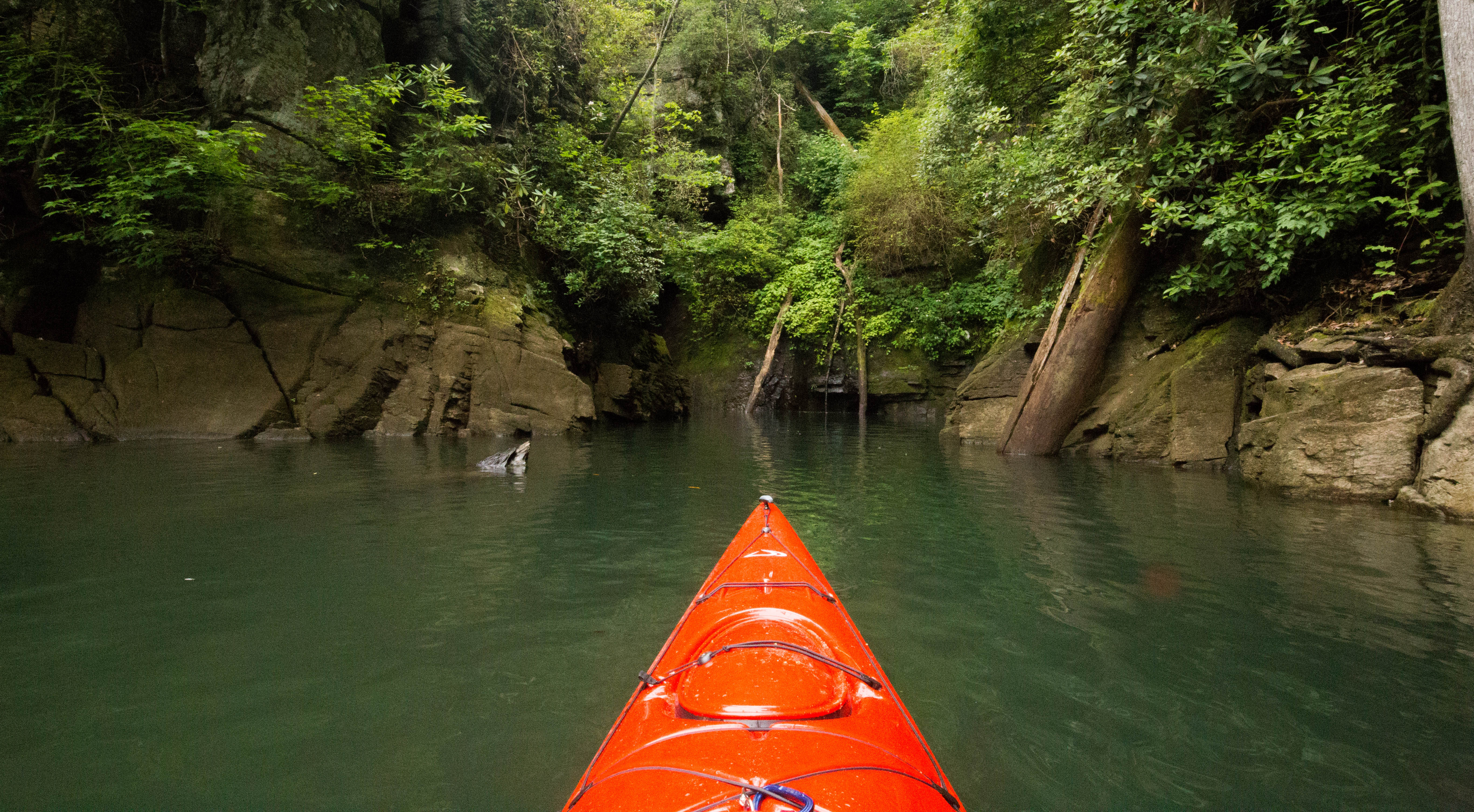
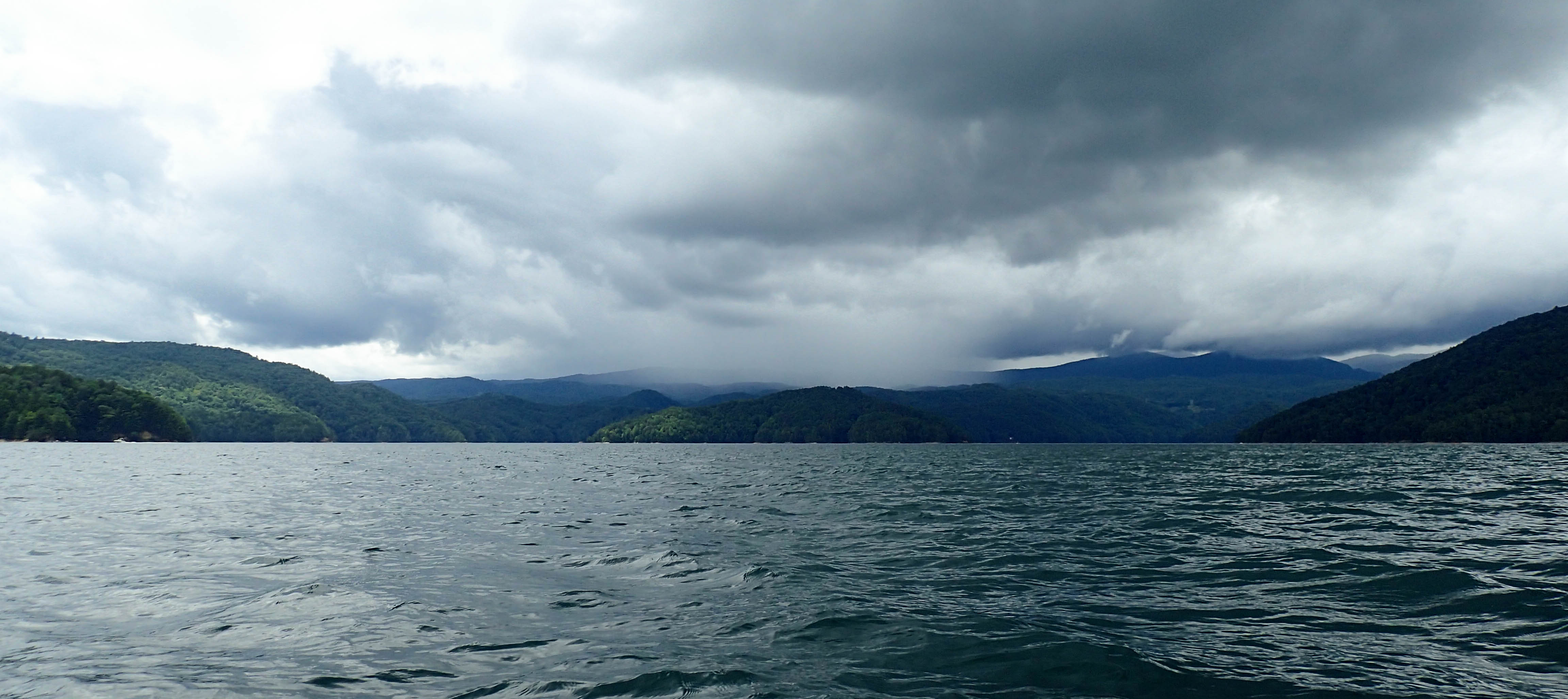
Lake Jocassee 
Toxaway River
The trail follows the shores of the lake for a mile or so. It then starts to depart the lake and climb up… and up… and up. It seemed to go up forever (maybe we were just extra tired from Heartbreak Ridge?)! The rest of the day was not too exciting – mostly just walking along more logging roads. There were a few short “trail” sections, but not many.
We had a quick lunch at Bear Gap Campsite but then back to walking along a logging road. We did eventually drop back down into the valley for a short bit to cross the Horsepasture River, but then it was back to a logging road again. We did come across a sign for the halfway point – YAY! We made it halfway!


Not far after the halfway point is the Bear Camp Creek campsite where we stopped for the night. One thing I must say is that all of the campsites along the Foothills are quite nice – almost all have benches and proper fire pits.
Day 4: Bear Camp Creek to East Fork Camp (Miles 38.7 to 53.0, Daily mileage: 14.3 miles)
The first stop of Day 4 was Hilliard Falls.

Somewhere between Hilliard Falls and the Thompson River we spotted a mama bear and her two cubs in the distance. We made some noise and they quickly scurried away. I wish I could have gotten a photo!
Just past the Thompson River crossing we passed another hiker who warned us about a bad blow down near Whitewater Falls. He was not kidding! It was quite tough to get around with my pack, but we managed to squeeze through.

Thompson River 
Whitewater Corridor Region
We took a quick break at Whitewater River to filter some water before our climb to the falls overlook. The climb to the top was not easy, but I had expected it to be tougher. We snapped a few quick photos of the falls and then continued on.

Whitewater River 

Whitewater Falls 
From Whitewater Falls, the trail crossed Whitewater Road where it continued to climb up. There are a few benches at the top where we had a snack and caught glimpses of Lake Jocassee down below.

The rest of the day the trail winded through the woods with glimpses of mountains in the distance. We called it a day at the East Fork Camp which is just past Sloan’s Bridge along the Chattooga River.
Day 5: East Fork Camp to Licklog Campsite (Miles 53.0 to 67.2, Daily mileage: 14.2 miles)
We followed the Chattooga River for the majority of Day 5. There were some really cool campsites along the river that I would love to come back and stay at one day.


We ended up setting up camp in a large campsite near Licklog Falls.
Day 6: Licklog to Oconee State Park (Miles 67.2 to 76.2, Daily mileage: 9 miles)
We woke up early on our final day of hiking. We skipped breakfast so we could get on the trail faster. It was just light enough out that we didn’t need a headlamp when we started hiking. The final ~9 miles went by pretty quick as it was almost all downhill. We made it Oconee State Park around 10 am. The only photo I got for the day was Bella in front of the sign staring at my car not far away. I think she was ready to go home 🙂

We ended the hike with a stop in Cashiers where we stocked up on ice cream 🙂


 We found ourselves a small beach cove named “Happy Cove”. We puled our boats up on shore and hid under a bank while the rain passed.